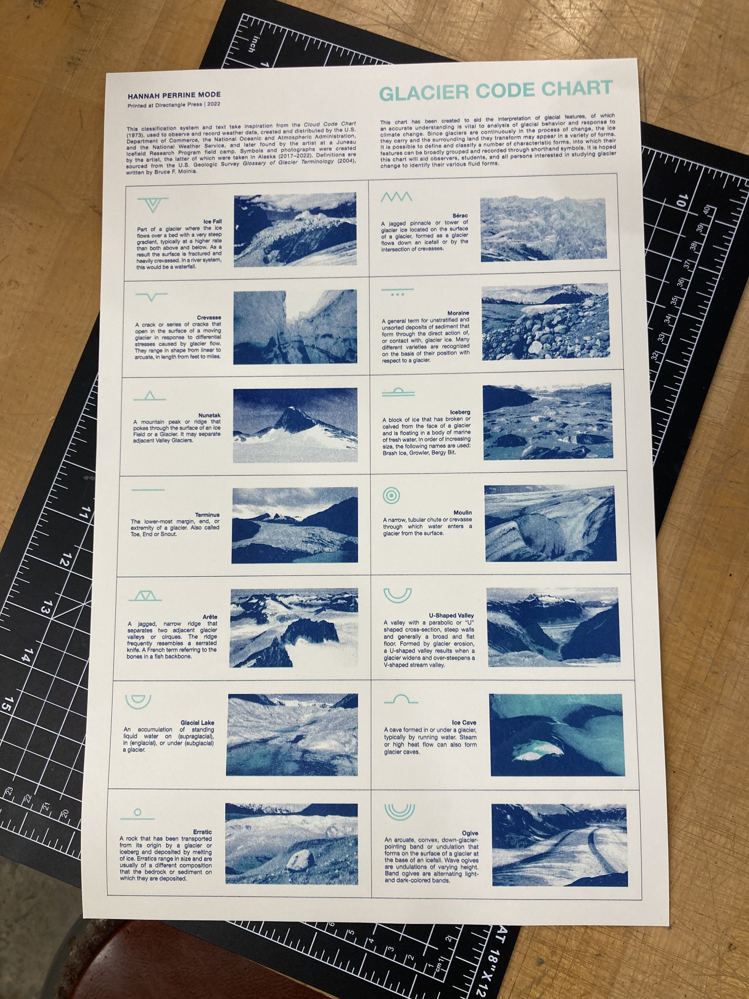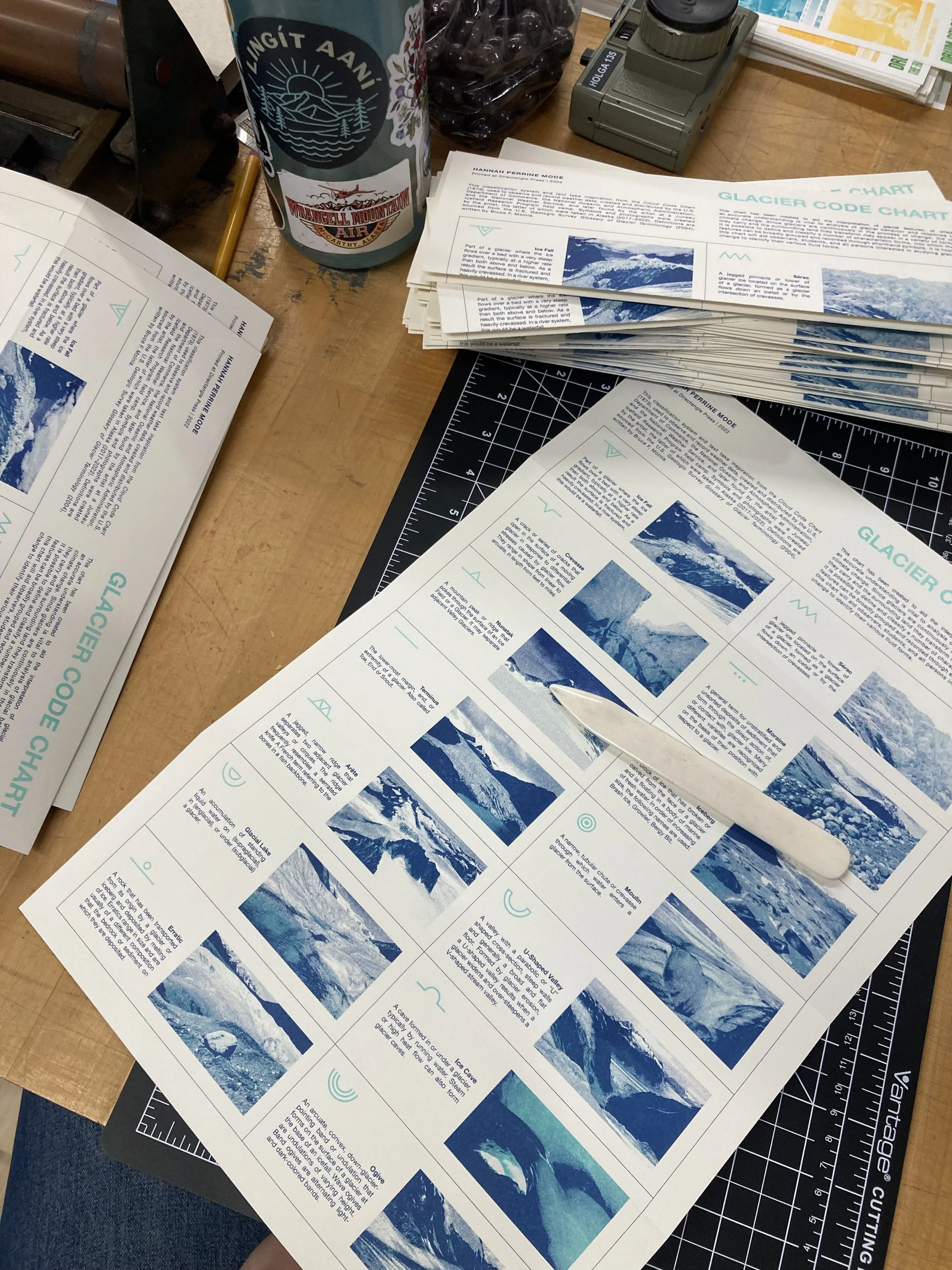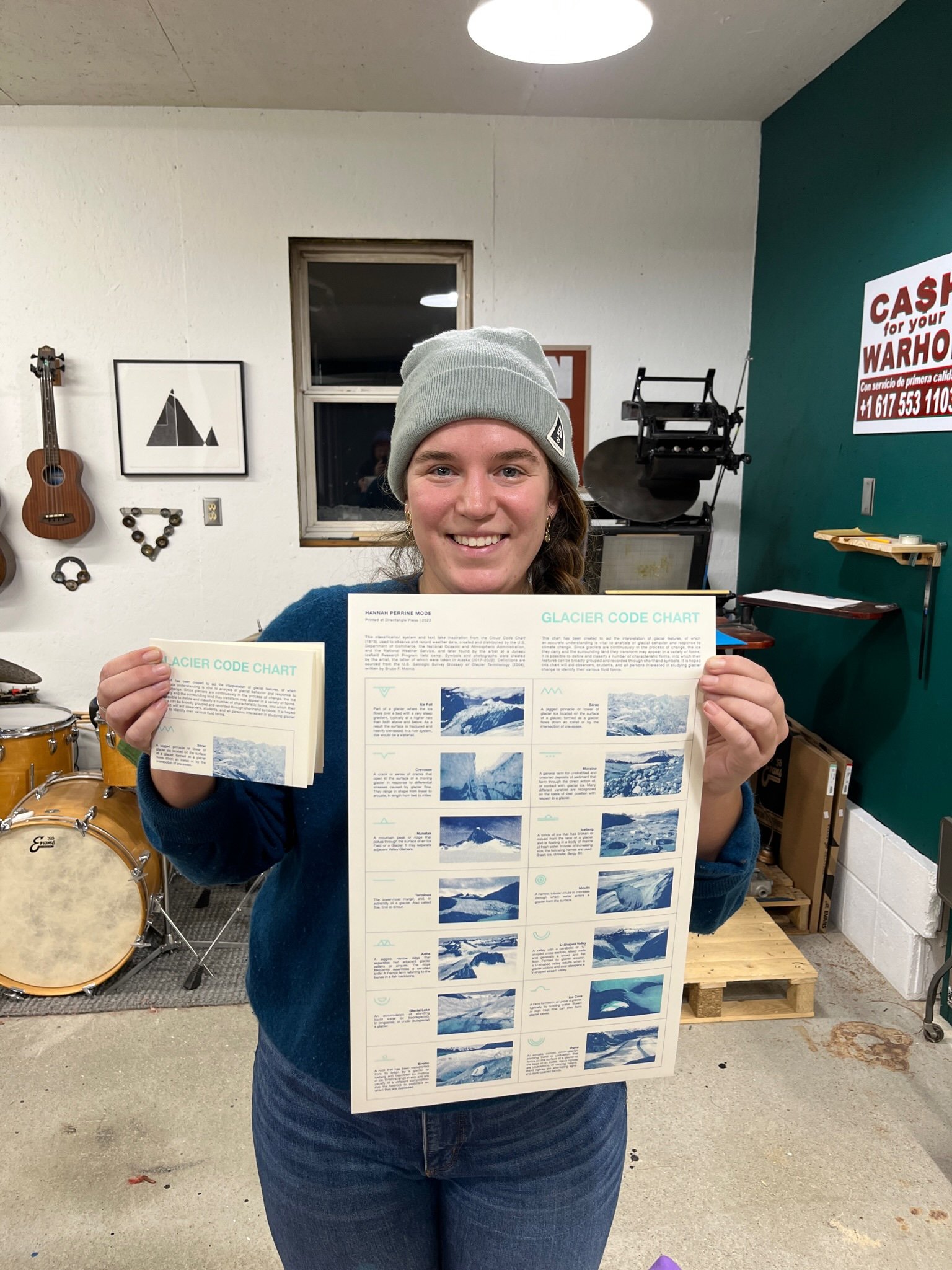
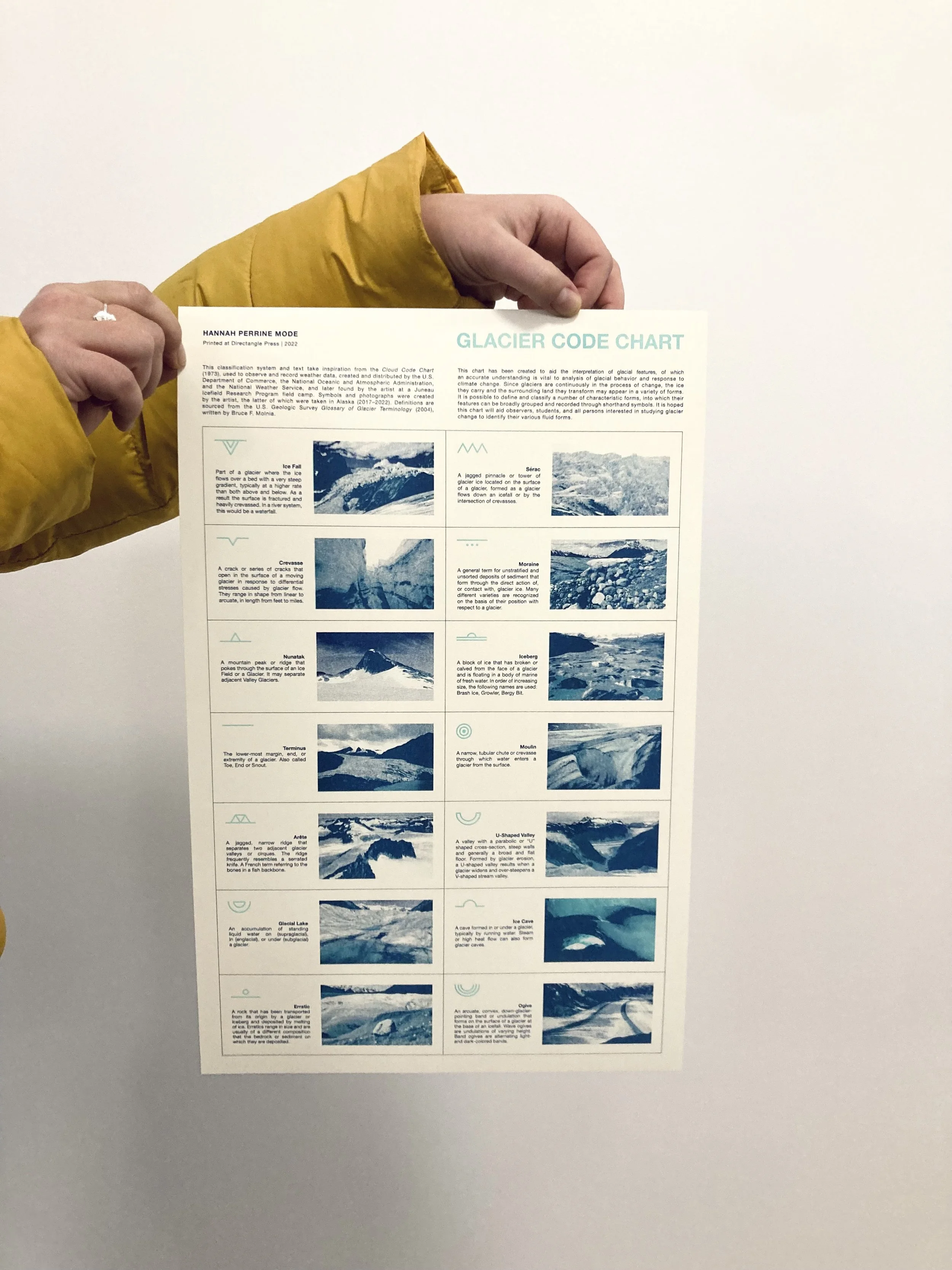
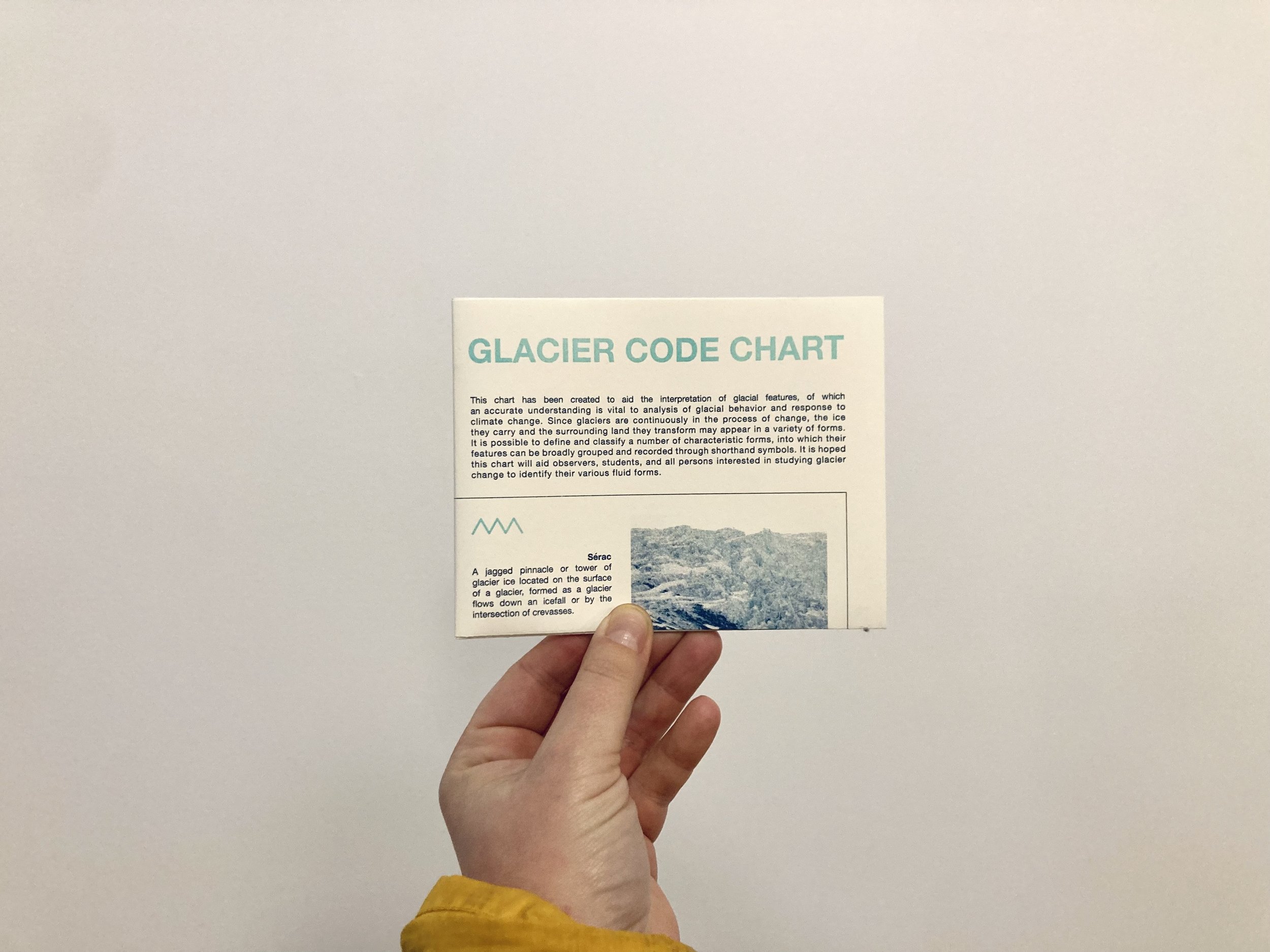
glacier code chart
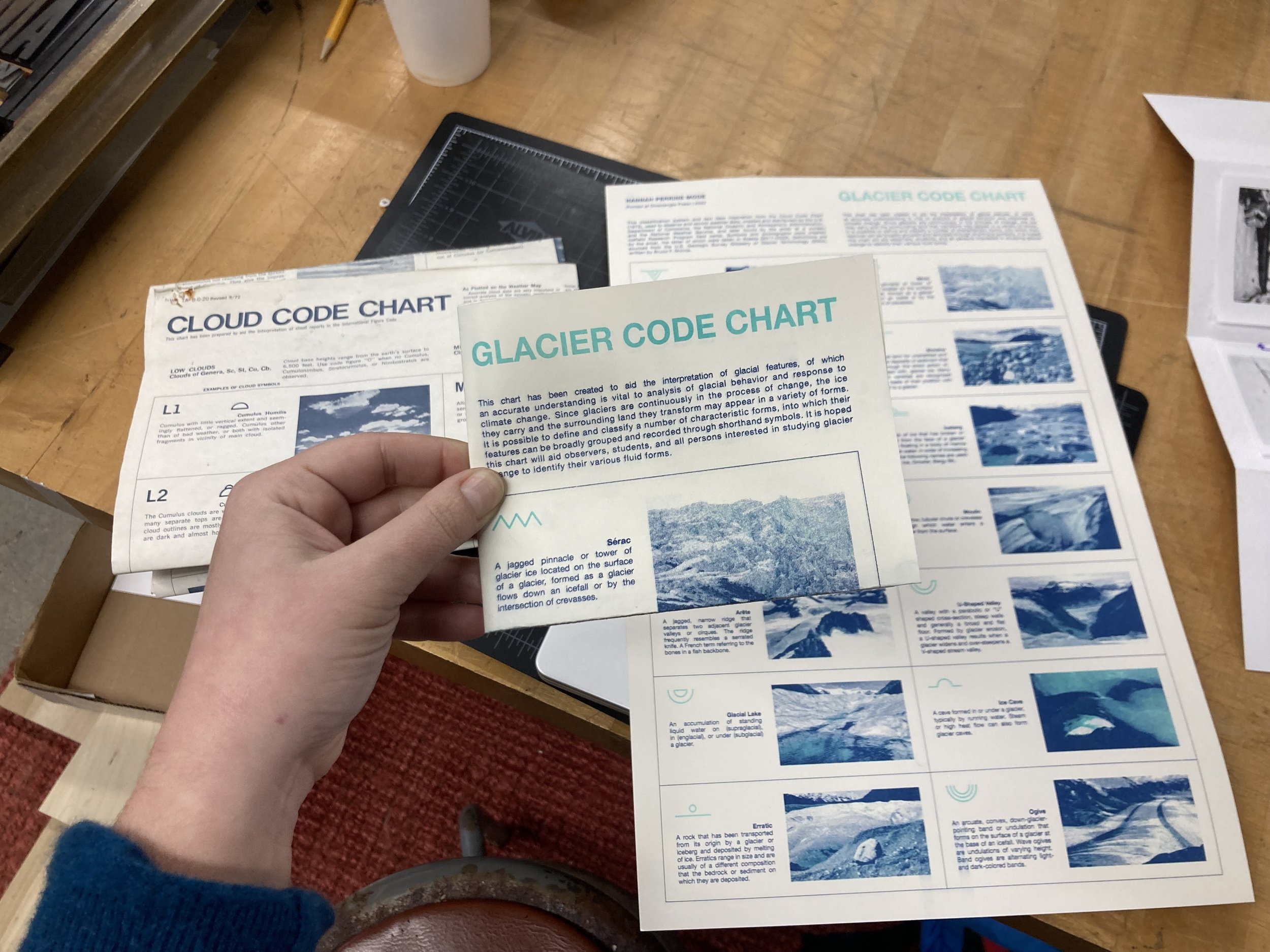
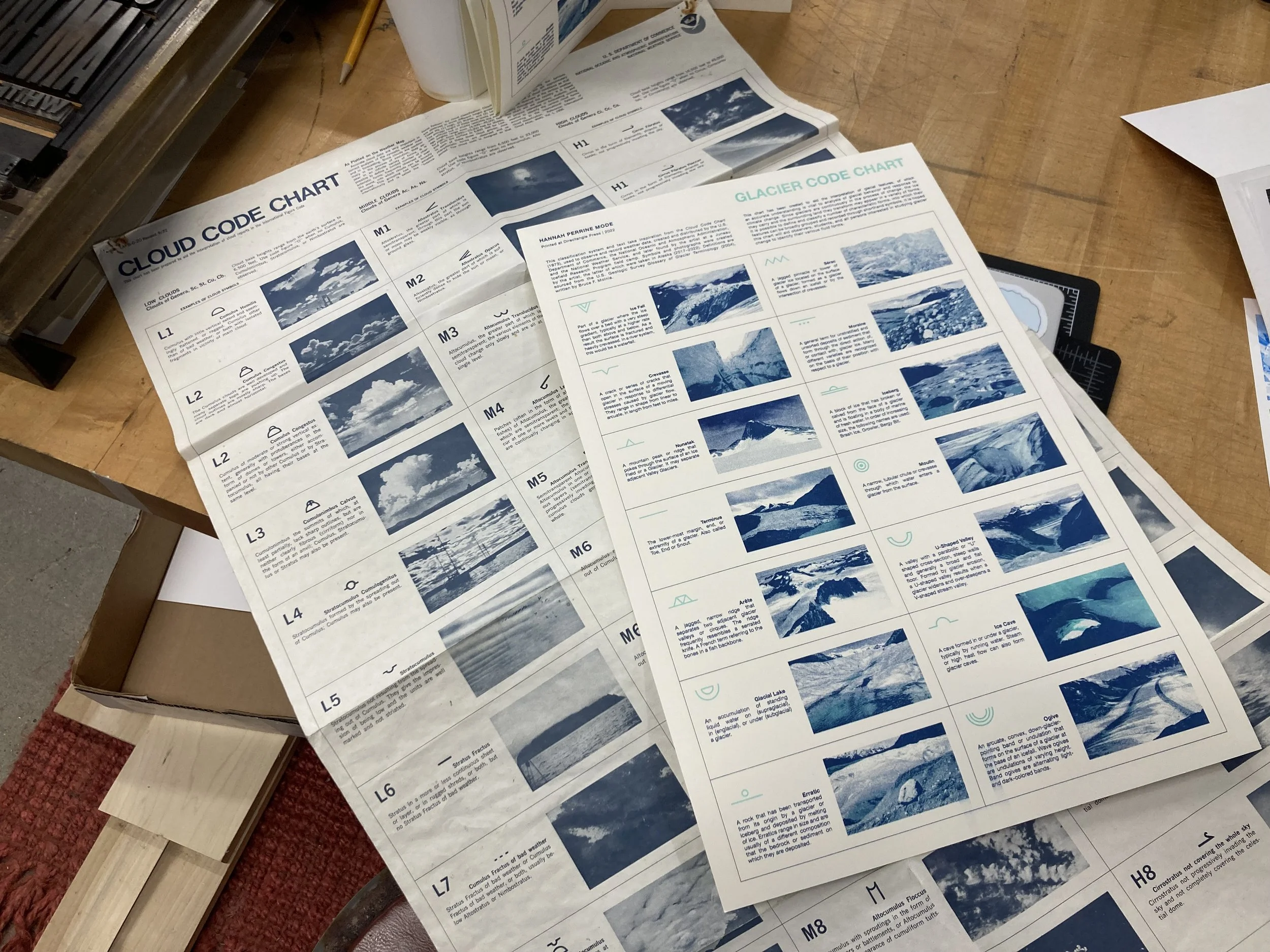
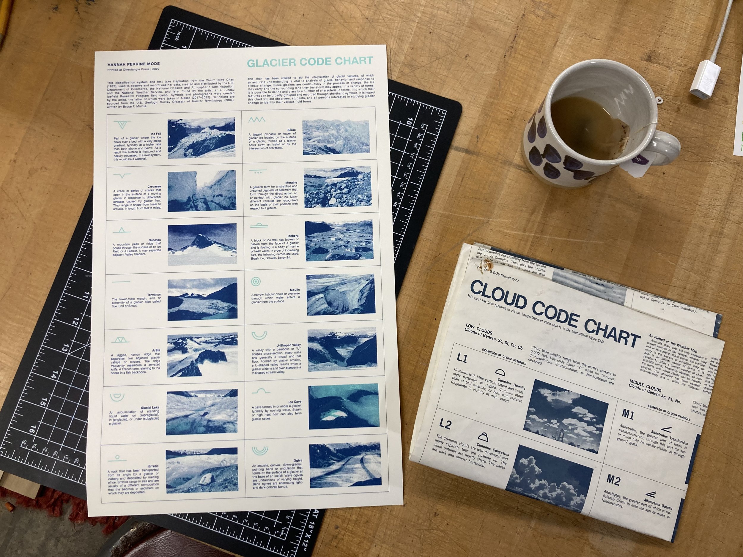
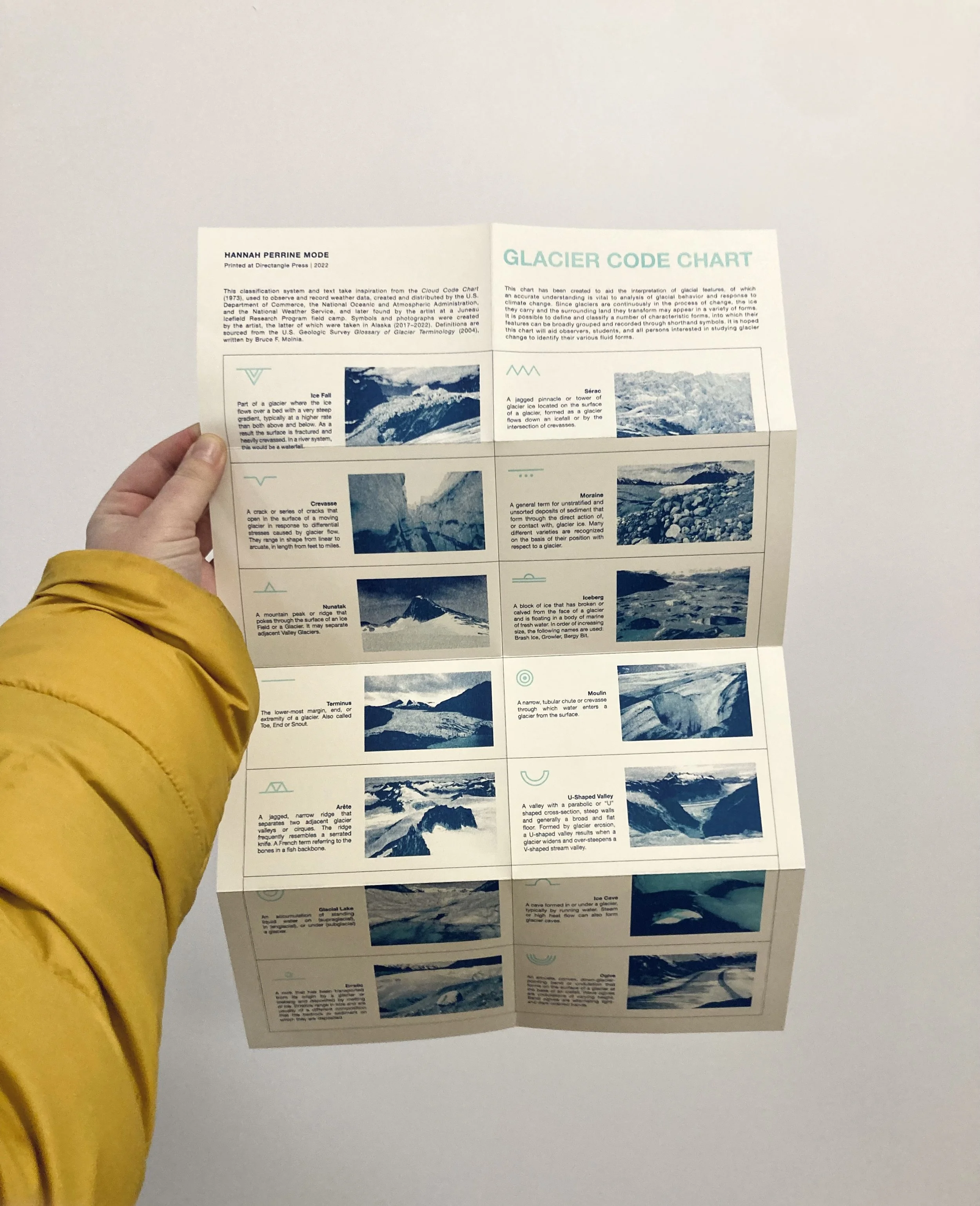
This classification system and text take inspiration from the Cloud Code Chart (1973), a system used to observe and record weather data. Cloud Code Chart was created and distributed by the U.S. Department of Commerce, the National Oceanic and Atmospheric Administration, and the National Weather Service, and later found by the artist at a Juneau Icefield Research Program field camp. Much like clouds (bodies of water in other forms), glaciers are continuously in the process of change. Glacier Code Chart is an original taxonomy* and shorthand for recording glacial features, to aid in observation and understanding of the ice they carry and the surrounding land they transform.
Glacier Code Chart was risograph printed at Directangle Press in Bethlehem, NH. It is 11x17in and printed in Federal Blue and Mint on paper, in an edition of 100.
*Symbols and photographs were created by the artist, the latter of which were taken in Alaska (2017–2022). Definitions are sourced from the U.S. Geologic Survey Glossary of Glacier Terminology (2004), written by Bruce F. Molnia.